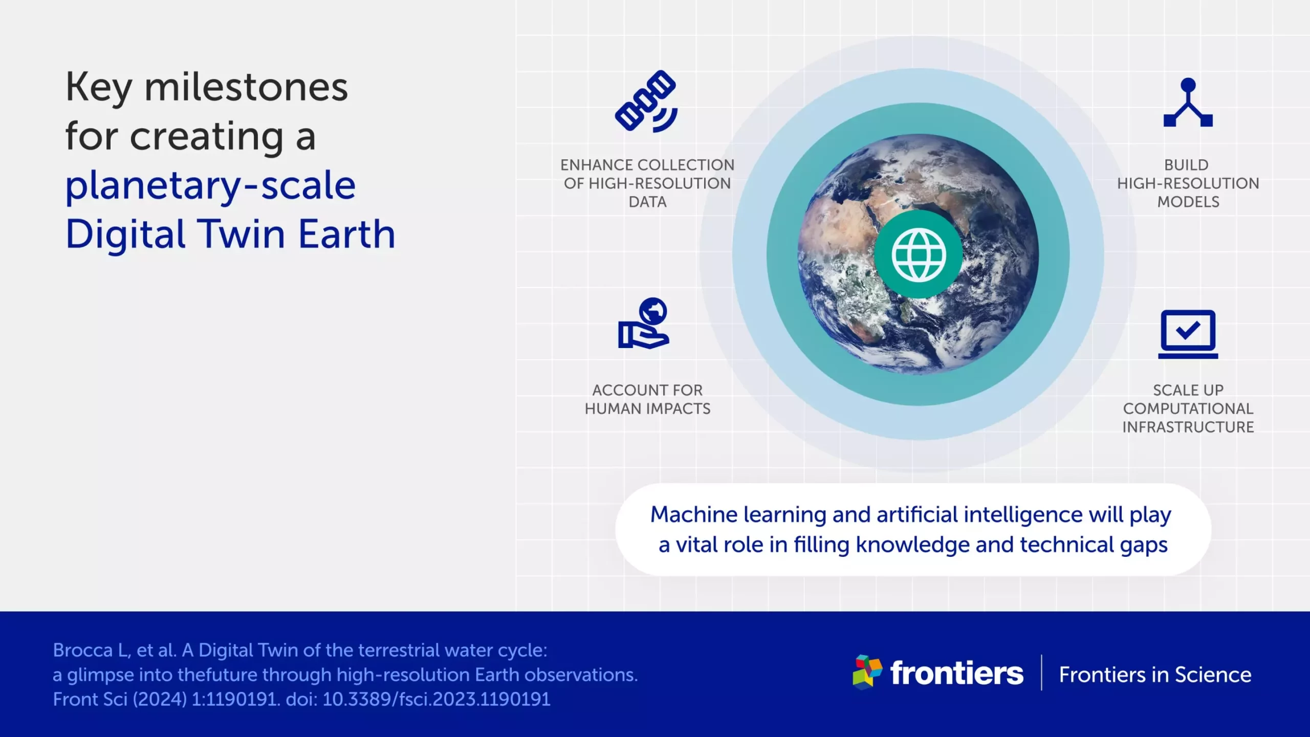
The water cycle is a fundamental aspect of the Earth’s natural processes, but predicting floods and droughts remains a challenge due to human impacts, climate change, and complex geography. To effectively model water on Earth, scientists require incredibly high-resolution data that spans vast areas. This data needs to account for various factors such as snowcaps on mountains and soil moisture in valleys. Recently, a group of scientists made significant progress by developing the most detailed models to date with the goal of simulating the terrestrial water cycle in the Mediterranean Basin.
In engineering, a digital twin is a virtual model of a physical object that can be tested without causing any damage. By creating a digital twin of the Earth, constantly updated with new data, scientists can simulate various scenarios, assess risks, and monitor the development of dangerous conditions. This tool is essential for sustainable development, protecting vulnerable populations, and managing water resources effectively. The scientists behind this project utilized massive amounts of satellite data, including measurements of soil moisture, precipitation, evaporation, river discharge, and snow depth. The high-resolution and frequency of this data provided a more detailed and nuanced view of the Earth’s water systems.
The development of the digital twin model was a collaborative effort between scientists and the European Space Agency. Initially focused on the Po River valley, the project expanded to cover other parts of the Mediterranean Basin. Future plans include extending the model to encompass all of Europe and collaborating with other researchers worldwide. The ultimate goal is to create an interactive platform that allows users to map risks such as floods and landslides, as well as manage water resources efficiently.
While the digital twin model shows great promise, several challenges remain. Delays in transferring satellite data to the model, the need for more ground observations to validate the data, and the growing complexity of data handling algorithms are just a few of the obstacles that need to be addressed. Furthermore, uncertainties and errors in satellite data must be properly characterized to ensure the model’s reliability. Artificial intelligence and machine learning are expected to play a crucial role in overcoming these challenges by improving data analysis, collection, and processing speed.
The development of a digital twin model for the Earth’s water cycle represents a significant advancement in water resource management and disaster resilience. By leveraging cutting-edge satellite data and sophisticated modeling techniques, scientists are on track to provide valuable insights that will help us better understand and address the complexities of the water cycle. Collaborative efforts between scientists, space agencies, and decision-makers will be essential in realizing the full potential of the Digital Twin Earth for hydrology.
Leave a Reply