Researchers at the Technical University of Denmark have developed a groundbreaking method that allows for the daily tracking of ice melt in Greenland. This innovative approach is based on the principle that the bedrock beneath Greenland moves slightly when the ice sheet melts. By measuring these subtle elevation changes, scientists can accurately determine the rate of ice loss on a day-to-day basis. This represents a significant advancement in monitoring ice mass loss in Greenland and provides a more detailed understanding of the processes driving the ice melting.
Traditionally, methods such as satellite gravity measurements and direct changes in ice elevation have been used to estimate ice mass loss in Greenland. However, these approaches only provide monthly or yearly estimates, making it difficult to capture sudden changes in ice mass loss that often occur during the summer. The new GPS-based method developed by researchers at DTU allows for the real-time monitoring of ice melt, providing more accurate and timely data for entities like the UN Intergovernmental Panel on Climate Change (IPCC) to assess the impact of Greenland’s melting ice sheet on global sea levels.
In addition to advancing our understanding of ice melt processes, the new GPS method has practical implications for residents in Greenland. By calculating daily changes in the ice sheet’s mass, scientists can now warn local populations of potential risks, such as flooded rivers resulting from extreme melting events. This real-time monitoring system can help prevent disasters like the collapse of bridges due to sudden releases of meltwater, as seen in Kangerlussuaq in 2012. The ability to provide early warnings based on daily ice melt data can save lives and mitigate the impacts of climate change on communities in Greenland.
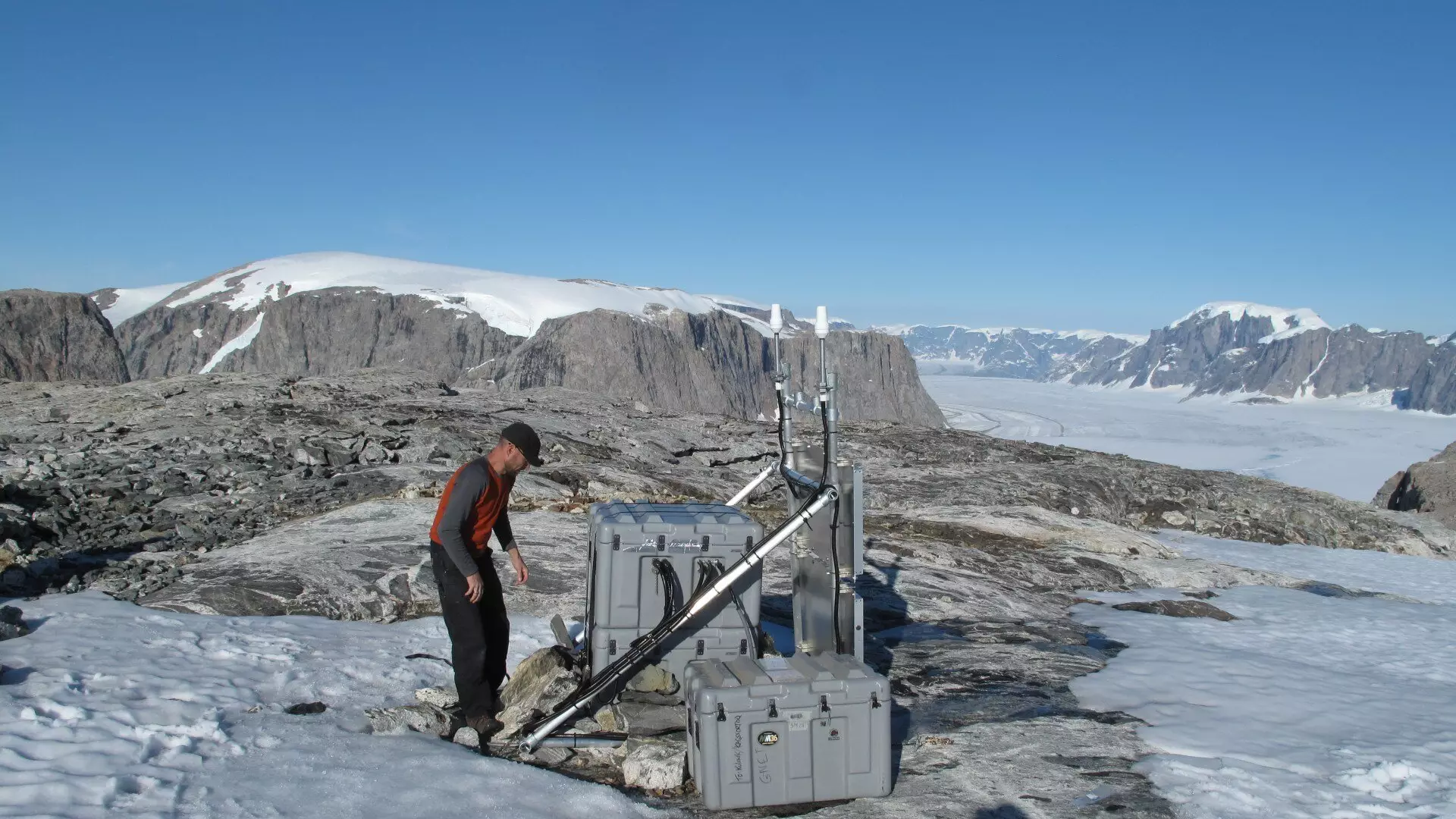
The new GPS-based method relies on the Danish state’s GNET, a network of 61 GNSS stations located around Greenland. GNSS technology, which includes systems like the American GPS and the European Galileo, enables scientists to detect movements in the bedrock with sub-millimeter precision over time. This high level of accuracy allows for the detailed tracking of ice melt rates and the identification of potential risks associated with rapid ice loss. The collaboration between DTU, the Danish Geodata Agency, and other research institutions highlights the importance of maintaining and improving measurement stations for ongoing climate monitoring efforts.
The development of the new GPS-based method for tracking ice melt in Greenland is the result of collaboration between DTU Space and DTU Computing Center. The computing power and expertise of these institutions have been instrumental in handling large amounts of GPS data and conducting simulations to refine the monitoring system. By leveraging cutting-edge technology and interdisciplinary collaboration, researchers are paving the way for more accurate and timely assessments of Greenland’s melting ice sheet and its implications for global sea levels.
The daily tracking of ice melt rates in Greenland represents a major step forward in our ability to monitor and understand the impacts of climate change on polar regions. The new GPS-based method provides real-time data that can inform decision-making, help protect local communities, and contribute to more accurate predictions of sea level rise. By combining scientific innovation, technological advancements, and collaborative research efforts, we can continue to uncover the intricacies of Greenland’s changing ice sheet and work towards sustainable solutions for mitigating the effects of climate change.
Leave a Reply