Climate change has brought about an increase in flood risks in urban areas, posing a serious threat to communities worldwide. Heavy rainfall disasters are no longer confined to specific regions, but have become a global issue that demands urgent attention. Traditional methods of displaying flood risk simulations on flat maps have proven to be limited in their effectiveness, as they often fail to provide residents with a comprehensive understanding of the potential risks they face.
The Innovation
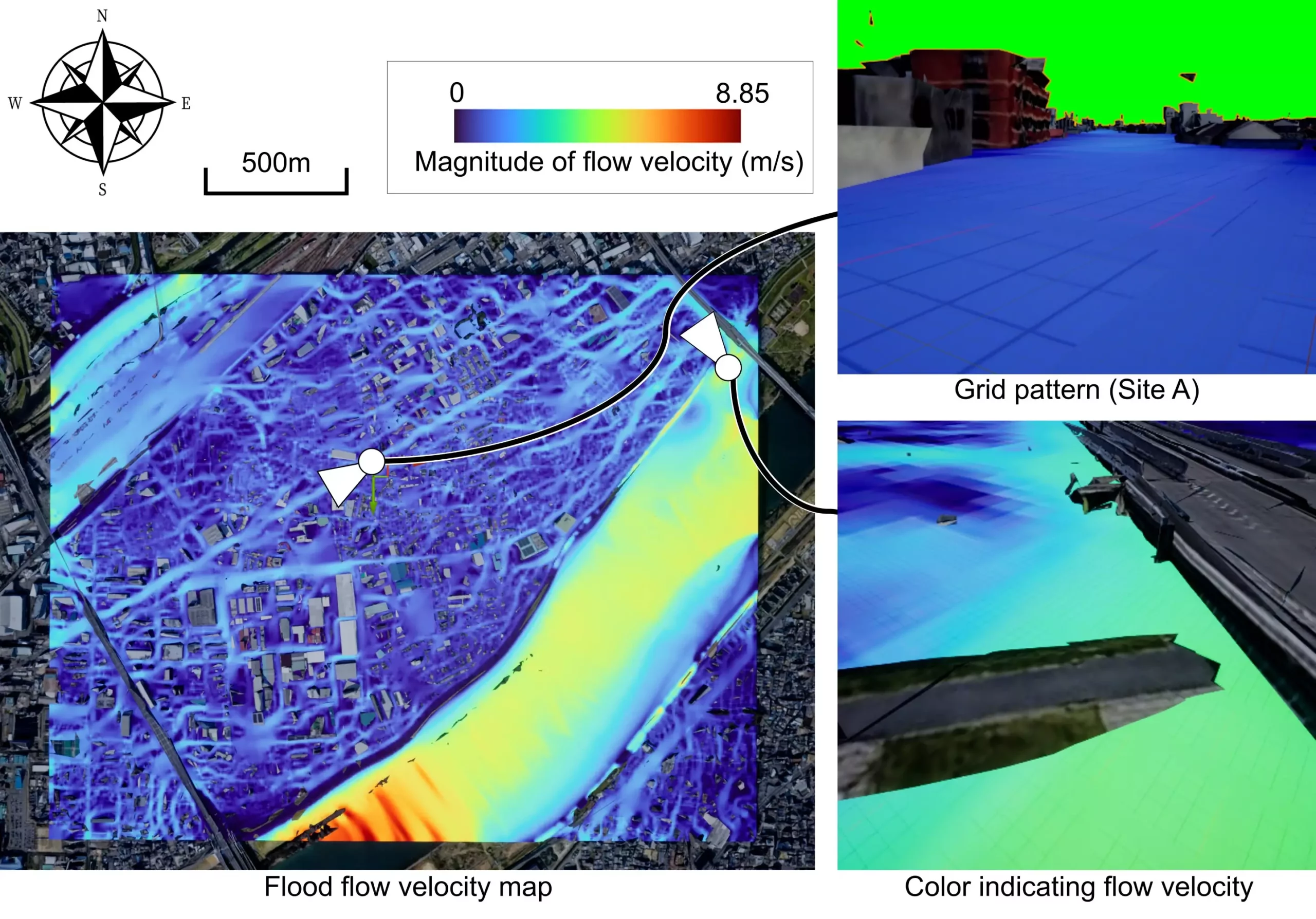
Researchers at Osaka University have developed a groundbreaking mobile mixed reality (MR) system that aims to revolutionize the visualization of flood risks in real-time. By leveraging server-based rendering and web-based access, this innovative system allows urban populations to access dynamic flood forecasts directly on their mobile devices. This not only enhances community preparedness but also improves response strategies in the event of a flood emergency.
One of the key advantages of this MR system is its ability to offload the computational workload to a server, thereby enabling efficient rendering of flood risk visualizations on smartphones and other mobile devices. By utilizing web browsers as the primary interface for accessing MR displays, the system eliminates the need for specialized applications, making it more accessible to a wider audience. This also means that multiple users can connect to the system simultaneously, facilitating widespread participation in flood risk visualizations.
The intelligent allocation of rendering servers ensures optimal performance and scalability of the MR system. By dynamically assigning the most suitable server from a pool of available resources, the system maximizes efficiency without compromising on the quality of visualizations. This approach democratizes access to advanced flood forecasting tools, enabling a broader range of users to engage with MR visualizations without the constraints of dedicated software.
Lead author of the study, Ryoma Tsujimoto, emphasizes the urgent need to mitigate flood risks in the face of climate change. The development of the mobile MR system represents a significant step towards improving flood risk visualization and increasing community resilience. By harnessing the power of technology, researchers aim to empower urban populations with the knowledge and tools needed to combat the growing threat of flooding.
Leave a Reply