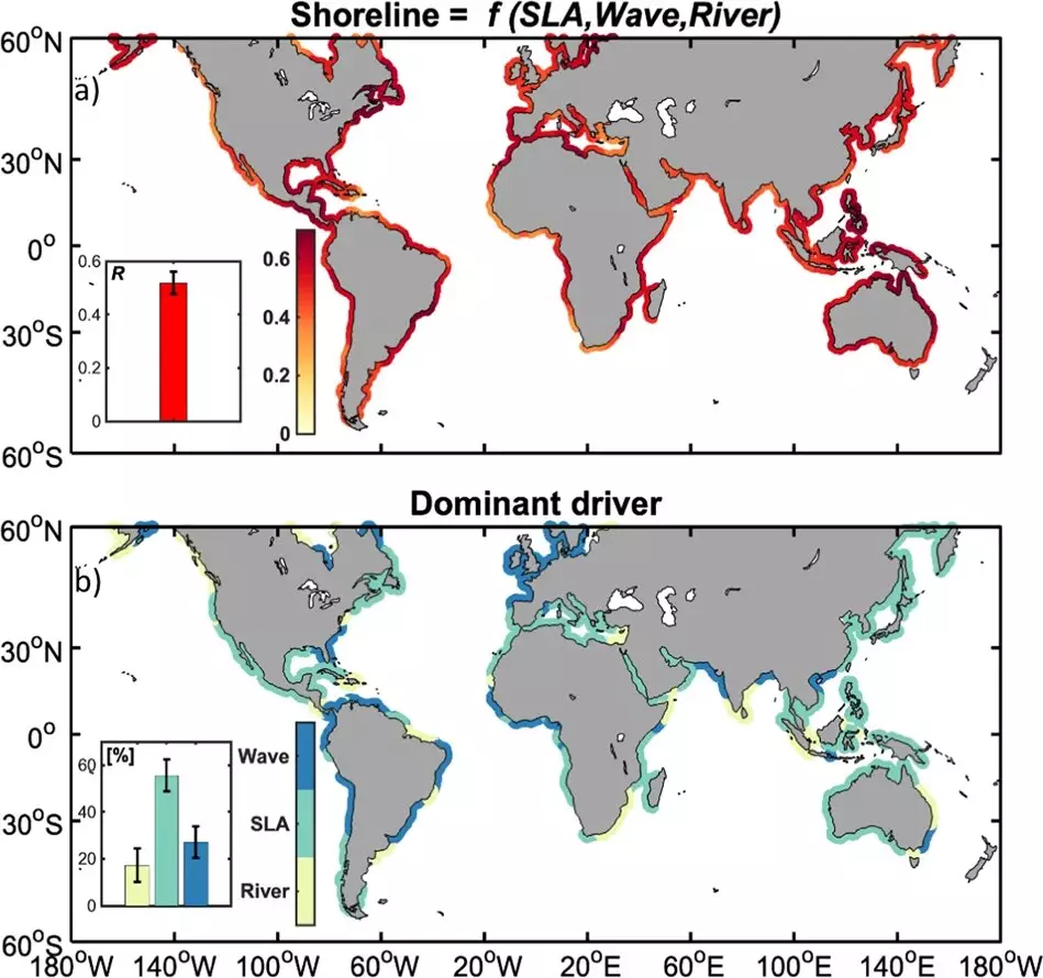
A new study published in Nature Communications by several research organizations, including IRD and CNES, has revealed the dominant impact of El Niño on the interannual evolution of coastlines on a global scale. The study used satellite data from 1993 to 2019 to analyze the positions of shorelines and sea levels and global numerical models to understand the influence of the climatic and oceanographic phenomenon ENSO (El Niño—Southern Oscillation) on coastlines.
The Impact of El Niño on Coastlines
Shorelines are impacted by three main factors: sea level, oceanic waves, and rivers. El Niño has a direct impact on each of these factors. Sea level affects coastal mobility, while waves impact both erosion and accretion, as well as water levels during storms. Rivers affect coastal sediment availability and water level variations induced by changes in salinity.
The use of satellite observations (Landsat) and high-performance Cloud-based calculations allowed for the first global vision of shoreline evolution. This satellite data was linked to climate forcing by observations of the sea level along the coast (satellite altimetry conducted by CNES and the AVISO+ data platform), models of waves and river flows. Using a global conceptual model that takes into consideration the influence of the key modes of climatic variability on these factors, researchers found that interannual changes in the shoreline are largely determined by different ENSO episodes and their complex teleconnections between basins.
Implications for Coastal Management
Coastal areas are fragile and complex dynamic systems that are increasingly threatened by the combined effects of anthropogenic pressure and climate change. Therefore, understanding and forecasting shoreline evolution is significant in the management of coastal areas. The study demonstrates the predictability of shoreline evolution on interannual scales in an intertropical band particularly subject to climatic hazards. It also highlights the benefits of using increasingly precise and frequent satellite observation data, available free of charge, on coasts that are often poorly documented. These data are invaluable tools for decision-making and anticipating coastal risks, particularly in the event of a major climatic event such as the next El Niño expected at the end of 2023.
On a decadal or centennial time scale, sea-level rise and the influence of rivers will dominate over waves, which are expected to show more contrasting trends worldwide. Consequently, potential threats can be anticipated so there is enough time to implement effective adaptation measures. This new framework for understanding and preventing coastal risks caused by the climate can help mitigate the damage caused by El Niño and other climatic hazards.


Leave a Reply