As urban landscapes become increasingly complex, the challenge of achieving high-precision positioning deepens. Traditional Global Navigation Satellite System (GNSS) technologies, such as Real-Time Kinematic (RTK) systems, often struggle in densely built environments where buildings and infrastructure hinder satellite signals. This leads to significant performance issues, such as reduced accuracy and inconsistent reliability, which can be detrimental for applications requiring precise location data. Past solutions have experimented with alternative technologies like Wi-Fi and Bluetooth; however, the recent deployment of 5G networks is demonstrating profound potential to address these challenges.
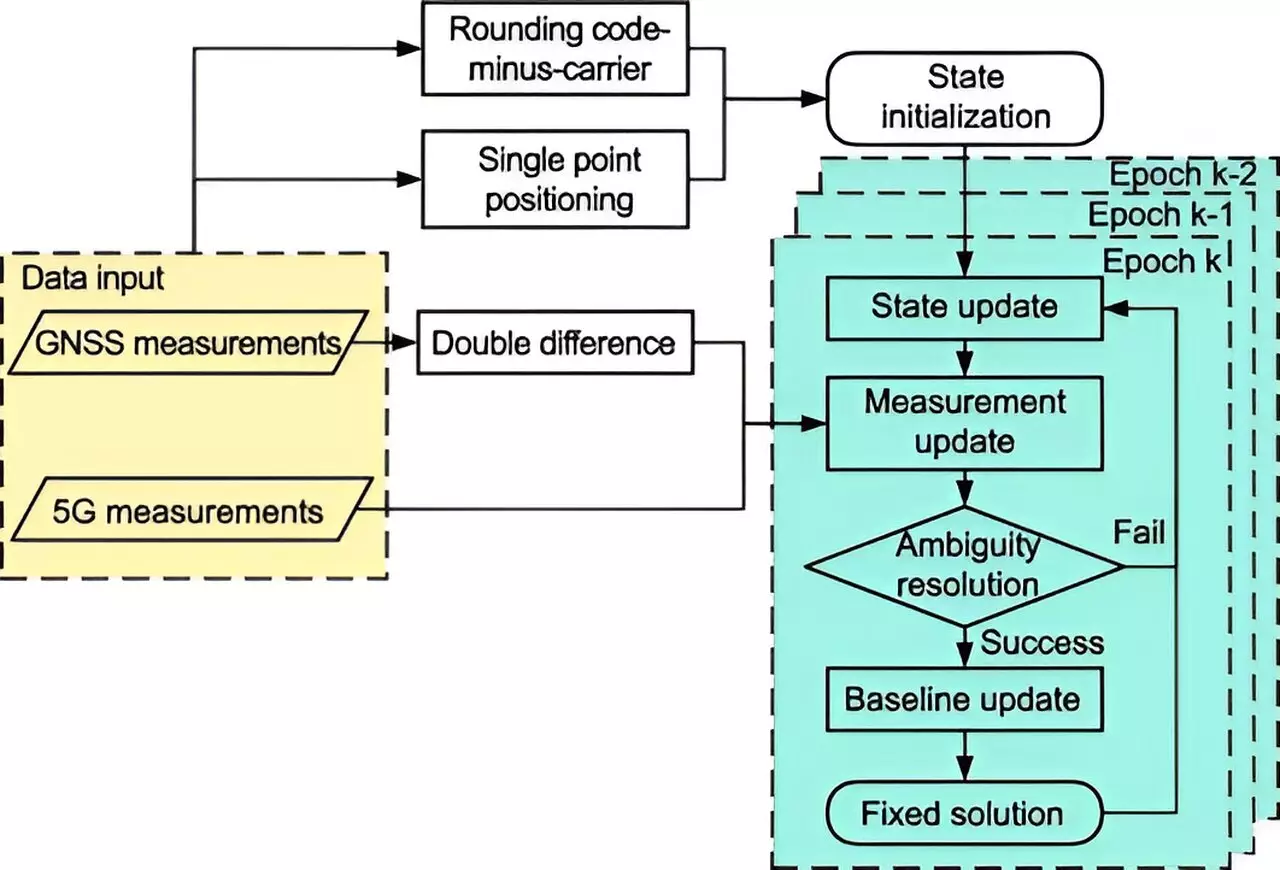
Recent findings from researchers at Tsinghua University illuminate a transformative approach to urban positioning through the integration of 5G technology with the BeiDou Navigation Satellite System (BDS). Published in “Satellite Navigation” on August 26, 2024, this research highlights how 5G’s superior speed, bandwidth, and infrastructure density can dramatically improve the positioning capabilities of BDS RTK systems. Utilizing an extended Kalman filter alongside advanced ambiguity resolution techniques, the novel system effectively integrates 5G observations with traditional satellite data, thus setting a new benchmark for accuracy in urban navigation.
By conducting rigorous assessments of the 5G-assisted BDS RTK positioning system, the researchers were able to quantify its effectiveness in urban settings. Utilizing gain factors to evaluate key performance indicators such as float solution and Ambiguity Dilution of Precision (ADOP), they established marked improvements derived from the integration of 5G technology. For instance, in Full Ambiguity Resolution (FAR) mode, spatial errors were minimized by 48%, while in Partial Ambiguity Resolution (PAR) mode, a decrease of 18.8% was observed. Furthermore, fixing rates escalated from 11.11% to 13.93% in FAR mode, and from 32.58% to 44.43% in PAR mode, signifying a robust enhancement in the positioning system’s reliability.
Dr. Tengfei Wang from Tsinghua University elaborated on the implications of marrying 5G with BDS RTK positioning, asserting that this integration prominently addresses urban hurdles by improving signal quality and satellite visibility. This transformation not only solves critical issues in positioning accuracy but also paves the way for more efficient navigation solutions within urban settings. Potential applications of this technology are extensive, ranging from autonomous vehicles and public safety services to initiatives aimed at building smarter cities.
Looking Ahead: The Future of Urban Positioning
As 5G networks continue to expand, the adaptability of this new positioning framework offers an opportunity for scalable implementations across various urban applications. Future research endeavors will be integral to further refining this integration, as testing in diverse real-world scenarios aims to enhance both accuracy and reliability. The promising fusion of 5G and BDS RTK systems signals a significant leap forward in positioning technology, suggesting a future where urban navigation can meet the evolving demands of modern society. Ultimately, the introduction of this innovative system could not only resolve existing challenges but also redefine the standards for precision in complex urban environments.


Leave a Reply