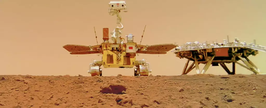
China’s Zhurong rover has made groundbreaking discoveries on Mars, shedding light on the planet’s geological history. Equipped with a ground-penetrating radar system, the rover has allowed researchers to explore beneath the surface of Mars and uncover intriguing findings. In this article, we will delve into the latest results from the scans conducted by Zhurong and discuss the implications of these discoveries for our understanding of the Red Planet.
One of the most significant findings from Zhurong’s mission is the identification of irregular polygonal wedges located at a depth of about 35 meters along the rover’s journey in Utopia Planitia. These polygonal features, ranging in size from centimeters to tens of meters across, have sparked great interest among scientists. While the exact origin of these wedges is still under debate, two main possibilities have been proposed: they could be the result of freeze-thaw cycles billions of years ago or the remnants of cooling lava flows.
China’s successful landing of the Zhurong rover on Mars on May 15, 2021, marked a historic milestone. China became the second country ever to accomplish such a feat, following in the footsteps of the United States. The adorable rover, named after a Chinese god of fire, embarked on its mission to explore the landing site, capture breathtaking images (including an endearing selfie with its lander), analyze the topography of Mars, and employ its ground-penetrating radar (GPR) instrument for scientific measurements. Initially designed for a three-month mission, Zhurong surpassed expectations and operated for over a year before entering a planned hibernation period. However, since May 2022, communication with the rover has been lost, leaving scientists eager to reestablish contact.
Zhurong’s GPR system has proven to be an invaluable asset in understanding Mars’s subsurface. Researchers from the Institute of Geology and Geophysics under the Chinese Academy of Sciences emphasized the significance of in-situ GPR surveying, which complements the data acquired by orbital radar missions like ESA’s Mars Express and China’s Tianwen-1 orbiter. The GPR scans conducted by Zhurong provide crucial details about shallow structures and composition within a depth range of approximately 100 meters along the rover’s traverse. This localized information is instrumental in enhancing our understanding of Mars’s geological features.
Utopia Planitia, a vast plain within Utopia, stands out as the largest recognized impact basin not only on Mars but in the entire Solar System, boasting an estimated diameter of 3,300 km. Zhurong’s exploration of this intriguing region has yielded fascinating results. Over the course of its mission, the rover covered a distance of 1,921 meters, providing valuable data about the geological formations in Utopia Planitia. The team led by Lei Zhang, in their research published in Nature, revealed the detection of sixteen polygonal wedges within a distance of approximately 1.2 kilometers. This suggests that similar terrain is widely distributed under Utopia Planitia. The team estimates that these polygonal features were formed 2.9 to 3.7 billion years ago during the Late Hesperian-Early Amazonian epochs on Mars, possibly indicating the cessation of an ancient wet environment.


Leave a Reply