
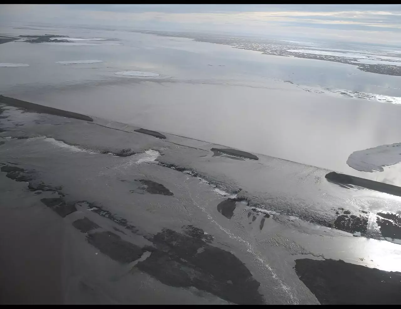
The massive flooding of the Sagavanirktok River in northern Alaska in 2015 had immediate consequences, including the closure of the Dalton Highway, but new research suggests that it also led to longer-term ground subsidence in the permafrost-rich region. Assistant professor Simon Zwieback from the University of Alaska Fairbanks Geophysical Institute conducted a study to investigate the aftermath of the flood and its effects on the landscape. The study, published in the journal Permafrost and Periglacial Processes, sheds light on the previously unknown changes that occurred in tundra and the permafrost landscape after the flood.
Zwieback and his team used space-borne remote sensing to study the Arctic and observed that areas affected by flooding experienced subsidence, with some areas sinking more than three inches in just a few years. The researchers also noticed a greening and wettening of the landscape, although these changes varied across the affected areas. These findings are crucial in understanding how these landscapes react to floods and can help in managing similar situations in the future.
The flooding of the Sagavanirktok River was primarily caused by a pre-existing buildup of aufeis, layered ice formed from the freezing of river water. This aufeis diverted the thawing river water away from its natural channels, leading to chaotic flooding that impacted the Dalton Highway. The floodwaters were further exacerbated by the complex relationship between rivers and floodplains in regions with continuous permafrost. Additionally, human activities such as oilfield expansion and the presence of the Dalton Highway have disrupted natural drainage in the area.
The flood may have stimulated ground subsidence by warming the permafrost, causing the ground ice to melt. Factors such as increased wetness, disturbance to the protective organic layer, or sediment deposition can contribute to this warming. Zwieback used satellite data from 2015 to 2019 to estimate ground deformation in the years following the flood. The analysis revealed widespread but variable subsidence, which was most pronounced in flooded locations and most active in the two years after the flood. The melting of ground ice was identified as the primary cause of the observed subsidence.
The presence of ice wedges in the permafrost adds complications to the subsidence process. These ice wedges, which can be several feet across and deep, form regular networks and are typically found about 30 feet apart in the study area. Initial subsidence can trigger changes at the surface, such as water ponding and a darkening and warming of the surface. This, in turn, leads to more thawing underneath, further altering the surface conditions.
While ice melting plays a significant role in ground subsidence, other factors can also drive deformation. Organic layer disturbance and sediment deposition contribute to subsidence by settling into the soil and eliminating insulating air pockets, allowing more heat to penetrate. Researchers found fine-grained sediment in the top two inches of soil plugs taken from two locations, but could not definitively attribute it to the flood. Nevertheless, these factors impact the overall stability of the landscape and contribute to subsidence.
Despite its negative implications, flooding can have long-term benefits for riverine landscapes. The deposition of sediment during floods allows for increased vegetation cover and organic matter, which insulate the soil. Over time, this process leads to the thinning of the active layer, the layer of soil that freezes in winter and thaws in summer. Thinning of the active layer promotes the growth of ice wedges and segregated ice, ultimately increasing elevation and reducing the frequency of future floods.
The research conducted by Zwieback and his team highlights the complex impacts of the 2015 flooding in northern Alaska. The study reveals significant ground subsidence and surface changes, driven by the melting of ground ice. Understanding these effects is crucial as the Arctic faces increasing climate stresses. With the region becoming wetter and experiencing changes in flood regimes, it is essential to comprehend how riverine landscapes respond to these transformations. This knowledge can guide future land management strategies to mitigate the impacts of flooding in permafrost-rich regions.
Radionuclides, often relegated to discussions surrounding nuclear energy and radioactive waste, have far-ranging implications for…
Landslides have long been a concern in areas like California, where the unique geography and…
In the vastness of our galaxy, among countless stars, lies a fascinating phenomenon known as…
This week marks a monumental milestone in astronomy as the Hubble Space Telescope celebrates its…
The enigma of dark matter has captivated the scientific community for decades. Although it constitutes…
As individuals age, the likelihood of encountering age-related macular degeneration (AMD) significantly increases, posing a…
This website uses cookies.